Category Archives: Photography

World War II’s last European Battlefield

It began at 1am on April 5, 1945. Armed only with sharpened shaving knives and their bare hands, Soviet Georgians exacted bloody revenge on their German captors. While the Georgians quickly and quietly dispatched tens of Germans, some of the Wehrmacht men got to their rifles. The gunfire alerted the German gun crews on the shore batteries … who then traversed their weapons so they could fire inland. What followed was a vicious guerrilla campaign that lasted for weeks after VE Day…

Over 60 years later, as you approach the island on the ferry boat from Den Helder, you cannot even see the concrete bunkers that formed this part of Hitler’s “Atlantic Wall” . Today, Texel is a charming holiday destination better known for surf fishing and lamb wool than its grim history as the only battleground between men of the Red and German Armies on the Western Front.

Remnants of a German bunker are in the foreground

The restored Texel Lighthouse - remnants of a German bunker are visible behind the grass in the foreground

Although Texel’s sleepy villages with winding brick lanes and perfectly flat pastures with grazing sheep are occasionally interrupted by more “touristy” towns like De Koog, the island is mainly a peaceful – if windy – place.  It’s one of the only parts of the Netherlands where you can experience a sense of remoteness, so I was shocked to learn a battle was fought here in World War II.

I learned about Texel’s World War II history by accident. The island’s small airport hosts an aviation museum that advertises a special exhibition on “the Georgian Uprising”. The weather in North Holland is not always reliable, so we soon found ourselves at the museum during a spell of Dutch Summer weather (damp, windy, etc.).

German bunker at Texel airport. Bullet holes are visible around the gun ports

German bunker at Texel airport. Bullet holes are visible around the gun ports

Thousands of Soviet Georgians serving in Stalin’s Red Army were captured by the Germans in 1941 during “Operation: Barbarossa”. Starved and brutalized in German prison camps, many were eventually shanghaied into the German Army’s new Ostlegion (“Eastern Legion “). 800 of these Georgians were sent to Texel, where they improved fortifications, drilled, and made contacts with the Dutch Underground – the Orde Dienst.

Having been informed they were being sent to Berlin in a last-ditch defense against the approaching Red Army, the Georgians hastily came up with a plan. When the signal was given they would quietly kill their German comrades with sharpened shaving knives and bayonets, seize the German weapons and – with the help of the local populace – take out the gun crews of the shore batteries. Once the island was secure, they would then radio England so the Allies could land on the island.

As Murphy’s Laws of Combat state: no plan survives first contact with the enemy. Operation: Day of Birth was no exception…

1 Comment

Filed under Germans, military history, Netherlands, Photography, Travel, World War II, Writing

A Penguin? In Africa?

What’s that? You didn’t know there were penguins in Africa? Neither did I.

On the way back to Cape Town from Cape Point we saw a sign indicating a Penguin Colony in Seaforth. Seaforth is part of a chain of beach-front towns on the Cape Peninsula facing False Bay. Seal Island, and a number of rocks jut out of the water just off-shore. The waters are home to penguins, cormorants, seals, and the occasional great white shark.

It was hard enough to believe that there are penguins in Africa, but Seaforth is home to a sizable colony of them. We never even made it to the colony before we’d bumped into this guy:

African Penguin

above: a penguin in Seaforth, South Africa

He waddled across the intersection in front of our bakkie, not a bother on him. He stood by this storm drain, and turned and cocked his head to get a better look at us. He acted like he owned the place. Standing there in his little tuxedo, I thought I detected a hint of disdain in his body language. I guess he wasn’t impressed by our shorts and sandals.

I wasn’t sure why this little water fowl was more out of place: because he was wearing a dinner jacket in a beach town, or because he’s a damn penguin in Africa.

At the Two Oceans aquarium in Cape Town, they’ve got a few pairs of penguins just like the one we saw.

African Penguin at Two Oceans Aquarium

above: African Penguin in Cape Town’s Two Oceans Aquarium

They were also fascinating to see, but there’s something special about encountering such an incongruity in the “wild”.

1 Comment

Filed under Africa, animals, humor, Photography, South Africa, Travel, Writing

Land’s End: the Cape of Good Hope

Cape of Good Hope

above: Cape Point (Diaz Point) 30 miles south of Cape Town

After leaving Muizenberg, we continued further south towards the Cape of Good Hope. There highway had ended, replaced by a two lane street that took us through a series of beach front towns. Backed up with beach traffic, we slowly cruised by restaurants, book stores, and endless beach-front bars. It was tempting to pull the bakkie over and have a sundowner, but we wanted to see Cape Point.

Leaving the towns behind us, the now lonely road ascended above False Bay around the rocky cliff side. I found it tough to concentrate on the road, as the views of the water were spectacular. We passed by rocky islands populated with penguins and cormorants; my wife scanned hopefully for more seals.

There was a line of cars to get into the the Cape of Good Hope Nature Reserve. Finally paying our entry fee, we crawled on the narrow winding road through the rich, green plant life towards Cape Point. Traffic backed up at one stage as a group of baboons had decided on a family gathering right in the middle of the road. Cars slowly drove around them, wheels on either side of the baboons griding dirt, rocks, and branches into the non-existent shoulder. Cameras clicked furiously and whirred furiously. I saw some of the most awful, hemorroidal baboon asses that I’ve ever seen. I cannot erase those nasty images.


Sighting the light house signified we’d arrived at Cape Point (also known as Diaz Point). Even though it was the end of the day it was still packed with buses, cars, and wandering tourists. Children screeched in delight seemingly from every direction.

The old light house stood at the top of a cliff, and the hike was a zig-zagging path interspersed with stairs. We met crowds of people coming down the steps. The tourists were a mix of Europeans, Asians, Africans, and Americans. It seemed like I had to stop every three minutes to take a picture for a Russian, Coloured, German, Afrikaans or African-American family. Fine with me, as each “interruption” allowed me to catch my breath.

Who could blame them for wanting photos? The scenery was spectacular: the greens of the park and the blues of the water enriched by the setting sun; the incredible distances playing tricks on our eyes, as the grand scale of the landscape reduced the cliffs and mountains in the distance to miniature.

Standing in front of the light house at the tip of that cliff meant the ocean (and the sheer drop to it) was on three sides of us. We were so high up that the water seemed placid. The breakers looked like an unmoving ridge of white snow or ice. You had to squint in concentration to see that it was actually movin, and actually quite rough.
Another trail wound around the cliff below the light house. From there, we could see a huge colony of cormorants. Leaning over the edge, we were blasted by an unrelenting wind. The cormorants expended little effort to ride these updrafts around and above us.

The path was devoid of people when we began walking back to the parking lot. The temperature was dropping a notch with each new gust of wind. When we got back to the car park, ours was the last vehicle remaining.

It was time for that sundowner.

Leave a comment

Filed under Africa, animals, Photography, South Africa, Travel, Writing

Cape Town: Surfing Near the Top of the Food Chain

I was desperate to try a bit of surfing in Cape Town. Naturally, there are loads of places trying to sell you package tours, but we simply jumped in our bakkie and headed south towards the Cape of Good Hope.

South of Cape Town is a peninsula made up primarily of two national parks (Table Mountain National Park and Cape of Good Hope Nature Reserve) and a chain of resort towns on the eastern coast. We pulled into Muizenberg, a town on False Bay known for its surf schools. After parking and dutifully paying the guard to watch our vehicle, I walked into one of the surf schools to suss things out.

The shop was bustling with activity. There were at least two groups suiting up and another group peeling off their wet suits and hitting the showers. Loads of rental boards were stacked up against the walls. A row of wet suits stood stiffly at attention on their hangars next to me. I asked if I could jump in on one of the lessons.

“I dunno,” the little surfer girl behind the register wondered. “They’re kind of young kids in both groups? Let’s see if I can sort you out.” And off she went out of the shop.

After a minute, she walked back in the shop with a guy I’d seen sleeping on his board in front of the surf shop.

“This is Jonno,” the girl indicated. “He’ll be your instructor for the next 90 minutes.”

Jonno rubbed the sleep out of his eyes and then offered his hand. He was the typical “surfer dude” right down to the sun-bleached, unkempt hair, and shark tooth necklace. He had his wet suit half peeled off, and I guess we’d interrupted his attempt to remedy his wet suit tan.

“How’s it, broo,” he muttered. “We gotta wait a while, yeah?”

“Sure,” I replied. “But why?”

“There’s a great white shark in the water? Shouldn’t be long though? Maybe 20 minutes, yeah?”

I’m not sure if it was a surfer thing, or an Afrikaner thing, but everything he said came out as a question.

“Oookay. How do you know there’s a shark in the water?”

“Just watch the flagpole, yeah? When the big white flag with the big shark on it comes down, it’s safe, yeah?”

Muizenberg

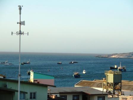
above: a white flag keeps swimmers and surfers out of the waters of False Bay in Muizenberg

“Gotcha,” I replied, plunking down my 150 Rand. “See you in 20.”

We walked outside.

“You want to come surfing too?” I asked my wife.

“With a shark in the water? Are you nuts?”

“You don’t have to swim faster than the shark, only faster than one or two other kids in the water,” I argued.

“No thanks. I prefer to stay at the top of the food chain.”

“But we’re still near the top out there. Just not at the top.”

She was already walking off. “I’ll see you back here in two hours.”

Muizenberg’s boardwalk had a respectable number of cafés and restaurants, so I didn’t have to worry about her.

The Cape Town area is well known for its great white shark population and for some spectacular shark attacks. The Saffers have a pretty elaborate shark detection system made up of aircraft, look-out towers, and the flag system to warn swimmers and surfers.

“The sharks love the seals, yeah?” Jonno explained. “Seal island is just offshore, which is why they cruise by here as well looking for a meal.”

“Have you ever seen a shark?” I asked.

“Ya ya. Plenty. Not too close, though, yeah? My dad’s board got bumped once though. Bumped once, and then it took out another surf board right next to him.”

“Close call.”

“Ya ya.”

The Afrikaner accent is so cool.

Summer holidays had just begun, and the beaches were packed. (In fact that very day, standard testing grades were released for South African high school students (“matrics”) across the nation. How one did on this testing determined one’s future. Amazingly, those who test highest are honored on the front page, and even more incredible, those who did crappy were shamed – their names also appeared in the papers with their miserable test scores!) It looked like everyone had come to Muizenberg to blow off steam – no matter what their results had been.

We found a little patch of sand to call our own so I could get some instruction on how to stand up on the board once in the water. After 10 minutes or so, the white flag with the shark profile on it came down and was replaced by a red one.

“What does a red flag mean?”

“It means that there was a shark in the water, but he’s not around here now.”

“Oookay.”

“But it safe now, yeah?”

We hit the water…

To say the water was cold is an understatement. It was freezing. A few people were simply taking brief dips in swimming trunks, but anyone on a board was in a wet suit. The water was choppy, but with very few pronounced waves worth riding.

“There’s on off-shore breeze, yeah? That’s why the water is so sloppy?”

“Wind coming from land makes for better waves?”

“Ya ya. There’s an excellent on-shore breeze on the Atlantic side of the peninsula right now. Eight-foot waves, mate. Imagine that, yeah?” His eyes became dreamy.

Despite the sloppy waves, I did get up on the deck after one attempt. (Years of snowboarding helps.) I got up a few more times after that, but I was really plodding through the water. We waited, in hopes that conditions would improve, and killed time talking about music. He was impressed when I told I’d seen Rage Against the Machine when their first album came out.

“When was that?” He marveled.

“Must have been around 1993,” I re[;ied.

“Whoah.”

He gave me God-like status when I told him I’d seen Metallica with Guns ‘n Roses and Faith No More in a stadium gig.

“Whoah. When was that?”

“Must have been ’91? 1992?”

“Whoah. I didn’t now Metallica was so old, yeah?”

I blinked in surprise. Old? Well, that was 15 years ago I suppose, but still.

Then I realized he was giving me that look. It was that look I used to give guys who’d seen Led Zeppelin live. It was a type of admiration, but kind of mixed with a “way to go, old dude” mentality.

Damn.

Conditions in the water only got worse. We were getting drubbed by small waves, none of which were worth riding. The red flag came down, replaced now by a black one.

“What does that one mean?”

“That means that they can’t see anything, yeah? There’s a lot of sand in the water? Decreases visibility.”

“So, is that bad?” I struggled.

“No. S’alright, yeah? See that over there?” He pointed out to sea. Through the waves, I saw a few shaped bobbing in the water. “Any shark out here will go after the seals before they come after us, yeah?”

I tried my best to catch a few more waves before I ran out of gas. 90 minutes of up-and-down on the deck and I was beat.

We walked past the red flag back to the surf shop.

I shook hands with Jonno before parting. “You should come back, yeah? Now that I got my test results, I’m here every day. Should be better conditions tomorrow. And Metallica’s coming here soon, yeah? Keep an eye out for that.”

1 Comment

Filed under humor, Photography, South Africa, surfing, Travel, Writing

On the Trail of the Kaiser’s Soldiers in Africa

Namibia Road Trip – Day #9: Ludertiz to Aus to Seeheim

On the road to Sesriem I’d picked up a locally printed book (“Mein Lieber Andreas! Treue Seele!”) that contained diary entries, recollections, and photos donated by German soldiers who’d been stationed in German Southwest Africa from the early 1900s until 1919 .

It held an interesting collection of details of daily life, which collectively gave a very rich picture of Namibia 100 years ago. The diary of one officer, a certain Unterzahlmeister Andreas Ohlsen, recounted his 1907 deployment route from Luderitz to the inland town of Keetmanshoop.

Schutztruppe Pad

above: A German map of the Ludertiz – Keetmanshoop route circa 1912

We followed his exact route nearly 101 years to the day.

Our Pad

above: The same route today. Note the Restricted Diamond Area (“Sperrgebiet”) to the south. The Namib Naukluft is to the north.

Naturally, this book contained quite a few memory holes. The diary entries were mostly fond recollections of soldierly bonding rather than details of their genocidal campaigns against the Hottentot and the Herero. I don’t think this was for political reasons. None of the horrors of war were present in their recollections. The losses of comrades-in-arms were glossed over. Their time in the POW camp in Aus sounded more like boarding school hijinks than 36+ months of purgatory in the desert. (I had to appreciate the story of how they secretly distilled schnapps – so-called “Kraal-Schnapps” – under the noses of the British guards.)

This wistful nostalgia was also colored with tragedy of another kind, as some of the Schutztruppe veterans writing in the book in 1943-44 were living in Koenigsberg. No doubt they were killed by the Red Army or had to evacuate only a few short months after fondly recollecting balmy African nights ’round the campfire singing dirty limericks.

Reading the experiences of these tough old soldiers humbled me a bit as I prepared for the day’s drive. I had over 200 miles of driving in front of me, and only two-thirds of it was on paved roads. I wasn’t looking forward to it, to be sure, but I felt guilty about wanting to complain.

Up until 1915, German soldiers arrived in Luderitz normally via steamship from Hamburg. After the damp climate of North Germany, I suppose the desolation of the Skeleton Coast and surrounding moon rock of Luderitz must have been a shock. In Luderitz they received their orders.

Once the Schutztruppen received their movement orders, the first leg of their trip inland would be via passenger steam train to Aus. The railroad track still runs parallel to the present-day B4 highway, but passenger train service stopped years ago. The final few miles of track to Luderitz were gone, but we could see where the tracks should have been; the embankment was still there, and it looked as if new ties had been lain. Perhaps the freight service would be resumed soon? In the meantime, a gaggle of five ostriches stood guard by the precious raw material left to lie unattended in the desert sun.
Our bakkie wasn’t terribly aerodynamic, so I expected we weren’t much faster than a steam train a century ago. In 1907 though, the rail ended in Aus and they had to switch to horseback. From Aus, we would leave the Schutztruppe in the dust.

In Aus circa 1907, German soldiers would be kitted out with food, water, weapons, and horses for the long trek to Keetmanshoop. They would form into a column, with mule-pulled wagons in the middle. At that time, hostilities with the local Herero and Hottentot weren’t quite at an end, so armed escorts were a must for any convoys carrying precious supplies further inland.

It was slow going on horseback. Water breaks were essential in that brutal heat. Additionally, the tracks they traveled on were not much more than ruts. Breakdowns were frequent, and wagons carried reserve wheels for this contingency. If an axle or more wheels broke, the wagon was offloaded and left behind as firewood for the next convoy.

The route followed a series of watering holes that had been converted into proper water stations with camp sites and hitching posts. It was critical to reach the next Wasserstelle before their existing ration ran out. I suppose the urgency of reaching the next station kept them focused.

In the account of Unterzahlemeister Ohlsen’s journey, it took a mule train over two weeks to reach Keetmanshoop. That’s over two weeks of riding in extreme heat. That’s two weeks of sleeping on hard ground. Two weeks eating by campfires, nights standing watch, and keeping weapons cleaned and maintained.

We covered that same distance in a truck in less than three hours.

And I still complained about my sore ass from the springs in my cushioned seat.

Leave a comment

Filed under Africa, Germans, Germany, History, humor, Military, military history, Photography, South Africa, Travel, World War I, Writing

And Wild Horses…

Namibia Road Trip – Day #9: Kolmanskop to Garub

Wild Horses of the Namib ahead

Caution: Wild Horses Ahead

There’s only one road inland from Luderitz: the treacherous and tedious strip of asphalt called the B4. Along this lifeline are two fascinating pit stops.

Kolmanskop Ghost Town

The diamond rush in Namibia began in 1908. According to our tour guide at the Ghost Town of Kolmanskop, over two tons of diamonds were extracted from the desert sand in less than a decade. Diamonds were so abundant, that wildcat prospectors could lie on their bellies and simply dig around the sand. In order to ensure the government got their cut during the mass extraction of mineral wealth, the town of Kolmanskop (Kolmanskuppe) sprouted up out of the dust and rock a few miles inland from Luderitz. This camp-cum-miniature city shipped in everything – including fresh water from Cape Town and coal from Germany. Once the diamond rush ended, the townsfolk disappeared, leaving behind a ghost town that can be visited today.

Kolmanskop

The desert climate has preserved a surreal, century-old snapshot. Summoning up the endurance to hike over the encroaching sand dunes, we walked through the abandoned homes, doctor’s offices, and commissary. Many rooms and fittings still had vestiges of their original paint job. Wires dangled from electrical fixtures. Doors still rattled on creaking hinges as the wind punched through the empty window panes.

A few neighboring buildings are still used by the government for workers going in and out o the Restricted Area (“Sperrgebiet”) . I assume they’ve purchased a more modern x-ray machine for cavity searches than whatever they used back in 1908…

The Wild Horses of the Namib

About 60 miles further west on the B4 is the Garub watering hole. There’s only a small sign off the B4, and we had to follow yet another winding dirt track rigged with sharp rocks and sharprt drops. Hard to believe it, but when we came over the next rise, there they were: The wild horses of the Namib desert.

The origin of the wild horses is still debated, although they’ve definitely been there for a century now. Most believe they’re simply the descendants of horses that escaped from ranches. Other believe they were released by the German Army during World War I to avoid handing them over to the invading Commonwealth soldiery.

Whatever their origin, they now eke out an existence in an incredibly harsh desert climate. I use the incredibly annoying word “eke”, because the horses did not look like they were living large. In fact, they looked downright unhealthy; they were incredibly skinny, with ribs and hip bones jutted through patchy, dirt-clotted coats. According to the board nailed up to the wall of the observation platform, the horses suffered an astonishing 60% mortality rate amongst foals due to the scarcity of food and water, the abundance of predators, and – increasingly – vehicle collisions.

Garub is an excellent place to spot the horses, as it’s the only permanent water source in the desert. The horses depend on it, and so did the ostriches, apparently. I had to admire their ability to survive in such a life-taking environment. And despite the searing heat there was a certain romantic feeling watching these horses ambling free, with any memory of subservience to man at least five generations in the past.

Leave a comment

Filed under Africa, diamonds, Germany, History, Horses, humor, Photography, Safari, South Africa, Travel, World War I, Writing

Commonwealth War Graves in Namibia

Namibia Road Trip – Day #9: Aus

Aus graves

I’m a big military history fanatic, so I leapt at the chance when I saw a sign indicating a Commonwealth Military Cemetery outside Aus, Namibia. Even my wife’s usual objections were quickly overcome, as it turned out to be an unusual monument to a catastrophic historical event.

What made this Commonwealth Grave site unusual was that:

1.) Few of the dead were killed in action.

2.) The cemetery contains both German and Allied dead together.

Unlike the United States, which either transports its war dead home, or – in special situations – lays its Fallen to rest in land donated by Allied nations (e.g., in France or the Netherlands), the British Empire always interred it’s dead where they fell. Since the they were very busy ensuring the sun never set on the British Empire, they fought in some very remote locations. This little cemetery near the mining town of Aus, Namibia certainly falls in that category.

The sign indicating the cemetery was on the paved B4 “highway”, but it lead us over the usual winding track made of jagged rocks, loose boulders, and dust. Our truck slid sideways as we negotiated our way up an arroyo that angled 45 degrees.

“Are we going the right way?” My wife fretted.

“Sure we are,” I pooh-poohed her. Actually, I had no clue if I was correct. As we fought our way up out of the arroyo, I couldn’t even see where the road continued, or even if the road continued.

Sure enough though, we came over the top and we spotted a small cemetery amongst twisted fencing and scraggly trees…

Aus Grave 2

A professor of mine in college once quipped that World War I was nothing more than a re-shuffling of the international pecking order. Apart from providing an opportunity to decimate a generation of young men, the Great War also allowed the Triple Entente (i.e., Great Britain) to relieve the Central Powers (i.e., Germany) of any valuable colonies they might have possessed. When hostilities broke out in 1914, Commonwealth troops poured into Namibia from South Africa. They were met by the Kaiser’s men. The Schutztruppen.

The Kaiser had only posted a token force in German Southwest Africa. After a few skirmishes, the Schutztruppen surrendered en masse to the South African troops in 1915. They spent nearly four years in captivity in a camp hastily erected outside Aus.

During their time as POWs, the German soldiers were industrious; they manufactured bricks – originally to build better accommodation for themselves, but later for profit (they sold the bricks to the South Africans!), they put on plays, and they even distilled schnapps. I read one first-hand account of the German’s schnapps still being discovered by a teetotaling guard who confiscated the equipment. The men didn’t wait too long before resuming production, albeit more discreetly.

Upon the cessation of hostilities, German Southwest Africa was handed over to Great Britain (who already controlled surrounding South Africa, Bechuanaland, and the two Rhodesias), and German soldiers were forcibly “repatriated” back to Germany in 1919. But, the Germans did leave around 60 men behind. They still rest here in this Commonwealth Cemetery.

Death came to Aus in 1918, but not at the end of bayonet. The Spanish flu didn’t discern between nations, and I counted roughly 60 German graves and 60 South African graves. I found a number of markers showing that the men died within days of each other in October, 1918. Friend and foe weren’t buried together out of some fraternal gesture; I doubt the authorities had much time for “proper” segregation of the dead, not with so many bodies waiting above ground in the ruinous heat.

The POW camp itself is now gone, replaced by a farm and small dwellings. I found only a few crumbling walls and nothing else. It stood on another hill facing the cemetery. The cemetery itself could have been considered “unsightly” alongside a “proper” cemetery; there was no grass, and no flowers. But there was a sense of order in there not known to the surrounding countryside, if only because someone had swept the dust prior to our arrival. A few iron crosses were crumbling, but more than a few of the Commonwealth graves had fresh flowers on them, possibly laid by descendants living in South Africa.

Seeing those flowers helped stave off the overwhelming sense of futility and loss I usually experience in a military cemetery. These men didn’t die defending their country. They fought on land that wasn’t even theirs. These men didn’t fall in battle. They died of disease. No movie or novel has been written about this sideshow to a greater conflict that was ultimately a “reshuffling of the international pecking order”, and only a preview of the horrors to come.

There had no glory save what their surviving family and concerned citizens choose to bestow upon them.

Aus graves #3

5 Comments

Filed under Africa, British, Germans, Germany, History, humor, Military, military history, Namibia, Photography, South Africa, Travel, World War I, Writing

Luderitz, Namibia: Fossilized Colonialism

Namibia Road Trip – Days #8 and 9: Luderitz

Luderitz Bucht

Luderitz Harbor – note the Germanic weather vane

Luderitz surprised almost as much as Swakopmund did, but for converse reasons. Whereas Swakopmund surprised me with its dominant German culture, Luderitz surprised me for its lack thereof.

I mean just look at the name: Luderitz. Can you get any more German than that? A look at a street map and all the names were German. I even found a Goeringstrasse! (Although I learned after we’d departed that this street fortunately referred to a former Commissioner of Southwest Africa, and not the mad Chief of Hitler’s Air Forces.) Naming a street after the prominent Nazi was such an act of defiance I simply assumed that Ludertiz would absolutely totally overshadow Swakopmund with its Teutonic swagger.

Wrong again.

The road to Luderitz was yet another strip of bulky black asphalt laid across a strip of lifeless white. To one side was the Namib Desert, to the other, the Restricted Diamond Area (“Sperrgebiet”). The only sign of life was the occasional ostrich or wild horse. The desert disappeared and the road then wound its way through a craggy, harsh terrain. The asphalt disappeared under skeins of sand slithering across the road. Strong gusts of wind beat at our truck. I could best compare the site to a harsh moon, or better yet, the lifeless planet LV-426 from my favorite flick. I know it sounds overly dramatic (or nerdy) to compare an African climate to a science fiction film, but I’m absolutely on the level when I say it was the spitting image, right down to the howling winds.

Rather than arriving at well manicured homes as in Swakopmund, we drove past a township situated on a barren hill. There were no municipal gardens, no orderly grid of streets. Unlike the Swakopmunders, the Luderitzers had never never been able to beat the grounds into a with the sense of order I’m sure they desired. Rough moon rock jutted out everywhere, reminding the locals just how tenuous a grip their civilization had there.

Luderitz slum

A not-so-Tuetonic Luderitz

Our accommodation was a German guest house. We navigated through sand streets (no paving here) and found the home ensconced behind high walls capped with cast iron fencing crowned with spikes. On all sides were “non-German” residents who didn’t bother with such extreme security measures (although they all had bars on their windows too).

Our host was a real, fifth generation Suedwester originally from Windhoek. He was a jovial chap and quite comfortable conversing in German (accent-free, of course), Afrikaans, or English. His wife greeted us in German; she spoke little English and no Afrikaans. (She was actually a German immigrant.) I couldn’t imagine how solitary her life was being unable to speak to anyone outside of their little enclave.

As if to underscore her solitude and helplessness, the neighbors across the street began to blast some awful Whitney Houston music from a parked car. I could see in her eyes the desire to whip out her Gesetzbuch and lob it across the street. But she had no power there. They had no power there.

Hard to believe that a steamship company once ran a regular route between Hamburg and Luderitz.

“Ja, it’s the end of the month,” she lamented, “and they tend to get very rowdy. You must be very careful if you plan on walking around tonight.”

They?

Our expectations of an orderly and Germanic Luderitz were further shattered when we visited the supermarket the next day. Back in Swakopmund, their Super Spar was as big as any supermarket in the US; the sparkling aisles in could easily accommodate three carts side-by-side piloted by enormously posteriored housewives – without their sweatpants even brushing. Swakopmund even featured a bakery, deli counter, butcher, and snack bar.

The Spar in downtown Luderitz was tiny. Sickly fluorescent bulbs flickered above us as I pushed my creaky cart over bumpy and ripped linoleum. The narrow aisles were crowded with shoppers. Instead of a deli counter, they had only N$ 5 heads of lettuce still covered in dirt and wormy tomatoes. Men stood idle outside.

I did meet a few German Luderitzers the next day, but never on the street. They were all like my German hostess: waiting behind their walls and watching German television on the satellite. Waiting to hand over the rest of the city to the native sons.

2 Comments

Filed under Africa, Anthropology, Germans, History, humor, Namibia, Photography, Travel, World War I, World War II, Writing